
Trail
Omaha · Managed by City of Omaha / Papio NRD
Keystone Trail
EasyBikeable
CyclingRunningCommuting
The backbone of Omaha's trail system. 28 miles from Cunningham Lake south to Haworth Park in Bellevue. Flat, paved, and connects to nearly every other trail in the network.
28.0 mi
Distance
2 hr 55 min
By bike
9 hr 34 min
On foot
Concrete
Surface
Trail map
Full screenLine from Douglas-Omaha GIS (DOGIS). Douglas-Omaha GIS (DOGIS)Sarpy County GIS© OpenStreetMap contributors
Along the trail
- Lake CunninghamTrailhead
- Craig StreetBridge
- Parking at Somerset ParkParking
- Read StreetBridge
- Sorensen ParkwayBridge
- Parking at Blair High RoadParking
- Blair High RoadBridge
- Fort StreetBridge
- Parking at Democracy ParkParking
- Parking at Esther Pilster ParkParking
- Little LeagueParking
- Water at Hillside Little LeagueWater
- Dodge StreetBridge
- Parking at Dodge StreetParking
- NFM Employee LotParking
- South 36th StreetBridge
- Parking at South 36th StreetParking
- Restrooms at South 36th StreetRestrooms
- Fort Crook Road SouthBridge
- Parking at Haworth ParkParking
What you might see
Research-grade iNaturalist observations along this trail in fall. Photos appear only under CC0 or CC BY.
- MonarchDanaus plexippus225 observations
- Common Eastern Bumble BeeBombus impatiens146 observations
- Western MosquitofishGambusia affinis141 observations
- Eastern Fox SquirrelSciurus niger137 observations
- Painted LadyVanessa cardui127 observations
- Differential GrasshopperMelanoplus differentialis105 observations
- Carolina MantisStagmomantis carolina90 observations
 Spotted OrbweaverNeoscona crucifera87 observations
Photo by Mirko Schoenitz · CC0 View photo
- Black SwallowtailPapilio polyxenes80 observations
- House SparrowPasser domesticus73 observations
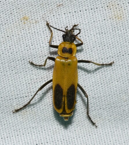 Goldenrod Soldier BeetleChauliognathus pensylvanicus71 observations
Photo by Wildreturn · CC-BY View photo
- White-tailed DeerOdocoileus virginianus70 observations
View on AllTrails
Opens this trail on AllTrails