Veterans Memorial Trail
Trail
Council Bluffs · Managed by Council Bluffs Parks / Pottawattamie County
Veterans Memorial Trail
EasyBikeable
Paved trail from the Veterans Memorial Bridge along Veterans Memorial Highway to East Manawa Drive. The 2023 map calls it 6 miles and connects it with the Western Historic Trails Center Link, Indian Creek Trail, and Lake Manawa Trail. The county line includes the 24th Street to Indian Creek gap. Drawn from Pottawattamie County GIS. 4.6 miles, 48 ft of climb.
4.6 mi
Distance
48 ft
Total climb
28 min
By bike
1 hr 33 min
On foot
Paved
Surface
Trail map
Full screenLine from Pottawattamie County GIS. Pottawattamie County GIS© OpenStreetMap contributors
Elevation
What you might see
Research-grade iNaturalist observations along this trail in fall. Photos appear only under CC0 or CC BY.
- Double-crested CormorantNannopterum auritum3 observations
- Great EgretArdea alba2 observations
- Common Eastern Bumble BeeBombus impatiens2 observations
- Western Honey BeeApis mellifera2 observations
- Great Blue HeronArdea herodias2 observations
- Ring-billed GullLarus delawarensis2 observations
- Prairie KingsnakeLampropeltis calligaster1 observations
- Canada GooseBranta canadensis1 observations
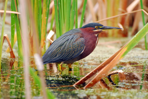 Green HeronButorides virescens1 observations
Photo by Tom Kennedy · CC-BY View photo
- Snowy EgretEgretta thula1 observations
- KilldeerCharadrius vociferus1 observations
- American CootFulica americana1 observations